NEWS

THE MUSEUM

The human presence in the territory of Fossato di Vico is likely to date back to the second
millennium B.C. In these places, people from Umbria, the Picenis and other people from the
Appennines slopes used to meet and exchange their products, at the Apennine pass.
In the III-II century BC the Romans built a post station equipped with a change of horses,
refreshment and a small village that took the name of “Helvillum”. The construction of the “via
Flaminia” made the settlement an important vicus enough to be present in all four Roman
Itineraria.
After the fall of the Roman empire in the battle of Tagina (today Gualdo Tadino) in 552 (a long
Gothic – Byzantine war), the village was probably destroyed and a new settlement happened due
to the strategic importance of the place but this time with the Byzantine name ‘Fossaton’ (fortification) whereas the ‘di Vico’ was added consequently in order to symbolise the
count Vico, an ancient noble from Fossaton. Following the fall of the Western Roman Empire, the
barbarian invasions and the Battle of Tagina (552 AD), “Helvillum” disappeared and a new
settlement was built in a more dominant position, this time with a name of Byzantine origin
“Fossaton” (fortification on the high ground), while “di Vico” was added in 1862, after the unification
of Italy, to distinguish Fossato from other namesakes, in honor of the Count “Vico son of Monaldo”,
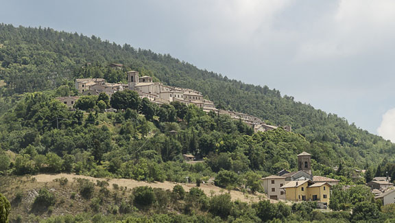
called “the Wolf”. The castle of Fossato, in the medieval period, represented a strategic point for
the whole north-east of Umbria and was disputed by Gubbio and Perugia. Even today it still
preserves its evocative medieval characters, with its walls, towers, the defensive and road network
of the internal alleys, with round stone vaults, pointed arches and coverage in wooden planks,
where the “Rughe” stand out, a very beautiful and suggestive walkway. In 1386 Fossato became a
Municipality proclaiming the “Statute” which guaranteed self-government, a statute which it
managed to preserve even under the dominion of the Papal States. In 1540 Umbria, Perugia and
consequently also Fossato di Vico passed under the Papal States, with which, (with the exception
of the Napoleonic parenthesis where Fossato was found as a borderland between the Kingdom of
Italy and the Kingdom of France and it is for this reason that customs was established at Osteria
del Gatto) it remained until the establishment of the Kingdom of Italy in 1860. Fossato di Vico,
today, as in the past, is still found as a borderland and passageway between the realities of
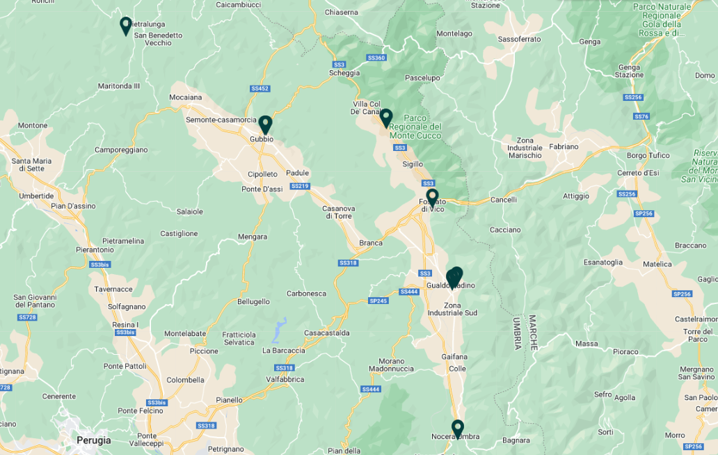
“Umbria and Marche”. It is part of the Monte Cucco Natural Park.

The civic museum: site and collection

The civic collection, which was organised in 2001, is housed on the top floor of the medieval building that was the original seat of the Commune and later accommodated the communal theatre.
The exhibition is laid out 2 rooms: the first introduces the history of the territory with the help of old geographical maps, charts and views ( from the 16th to the 19th century) and a selection of objects from the Roman age to the modern day; the second room displays in chronological sequence various ancient and recent finds that document, from prehistory to the modern day, the life of an area whose centrality is based, rather than on its size and the wealth of the settlement, on the gradual organisation of the traffic routes that intersect here. In addition to isolated finds, the museum contains materials from the Aja della Croce area , where the ancient settlement, immediately above the church of San Cristoforo, on the rocky spur dropping sheer to the valley below, has been identified. In this area, excavations carried out on more than one occasion between the mid 19th century and the mid 20th century, identified ruins of a Roman house with mosaic floors and a cistern, datable to the 1st century B.C. Evidence of an older building (column drums, capitals) has been found inside the cistern, including an important inscription in the Umbrian language, which documents the cult of goddess Cupra.

The goddess Cupra

In 1868 an Umbrian inscription dating back to the 2nd century B.C., now in the National Archaeological Museum in Perugia, was found in the Aja della Croce district. The epigraph was engraved on a sheet of bronze and fixed on a terracotta artefact that may be taken to be the mouth of a large cistern. The text, in the Umbrian language but the Latin alphabet, records the construction of an enclosure and a cistern inside the sanctuary of the goddess Cupra.
The building work, whose cost is also mentioned ( 59 or 159 asses, depending in interpretation), was overseen by Vibius Varius and Titus Fulonius, who held the office of marones: this magistracy, which is also documented in other Umbrian towns, was in fact specifically in charge of managing building activity. The goddess Cupra was venerated in Umbria and in the nearby Picene area. Her sanctuaries are located at Colfiorito, Cupramontana and Cupramarittima. According to several Latin authors the Italic term cuprius means “good”. Cupra would therefore be the “Good One”. However, it is possible that the origin of the name relates to the epithet “ the one from Cyprus”, in other words the Cypriot Aphrodite who is often found venerated, in different forms, in the ports on the Tyrrhenian and Adriatic coasts of Italy. According to the geographer Strabo (late 1st century B.C.), Cupra was an important divinity from Etruria.
The spread of the cult of Cupra involves the key junctions along the trade routes by land (Cupramontana, Colfiorito, Fossato di Vico) or by sea (Cupramarittima), of which the goddess would have been the protectress.


The Via Flaminia

The Via Flaminia was opened in 220 B.C. by the censor Caius Flaminius, a magistrate charged with the inspection of public works, immediately after the victories won by Rome over the Gallic peoples who had settled in the Po area. Much of its route crossed Umbrian territory , on its way from Rome to the colony of Rimini, founded in 268 B.C., and it became the main link to the north of the peninsular.
As it entered Umbria, the Flaminia crossed the Tiber over a bridge that gave its name to the modern locality of Pile di Augusto, in the Otricoli district. After having crossed the town of Ocriculum it headed towards Narnia (Narni) , the first colony founded by Rome in Umbrian territory (299 B.C.). Here it forked into 2 branches. The older route continued towards Interamna (Terni), as far as Spoletium (Spoleto) and, having passed the towns of Trebiae (Trevi), Fulginiae (Foligno), Nuceria (Nocera) and Tadinum ( Gualdo Tadino), it crossed the Appennines at the Scheggia pass, the lowest mountain pass along the entire ridge (642 m above sea level), originally located in the territory of Gubbio, and reached the Adriatic coast at Fanum Fortunae (Fano) , before joining up with the main route just next to Forum Flaminii, a short distance north of Foligno. This second route, which was more convenient and shorter than the one via Spoleto, over time became the one that was more used, to the extent that as of the 1st century B.C. it was identified ad the Via Flaminia proper.
The Via Flaminia , which passes all the colonies founded by Rome in Umbria, was built as military road, intended first and foremost for the rapid movement of armies. Its importance justifies the constant care reserved for it: at the end of the 1st century B.C. Emperor Augustus himself promoted a general restoration project, with the reconstruction of many of the bridges and the viaducts still visible along its route.

The bridges along the Via Flaminia

South of the town, near Palazzolo, a Roman bridge can be seen that once crossed a river that has now disappeared. Situated slightly further west than the present-day state road, it indicates the ancient course of the Via Flaminia.
The arch made of large wedges of fresh travertine, dating back to the late 1st century B.C., still remains. The parapets, built of small blocks of pink limestone belong to a restoration datable to the 2nd century A.D.
Continuing northwards, at the foot of the mediaeval village the bridge of San Giovanni is visible, all of which remains is part of the arch the parapets made of limestone using the “opus quadratus” technique (the brick part is a modern restoration). Beyond the town, just north of Sigillo, there is another imposing structure at Ponte Spiano, where the old Flaminia coincides with the present-day state road. It is also made of limestone using the “opus quadratus” technique and its arch and mighty buttresses survive, whose original width was about ten metres.
Even further north, just next to the village of Scirca, the road crosses the river of the same name over the so-called Etruscan bridge, which was intact until the Second World War, when it was blown up during the German retreat. Several large ashlars from the arch are visible on the bed of the river below.

MeTU’s MAP

img_tour_virtuale_Antiquarium

VIRTUAL TOUR ANTIQUARIUM

MORE

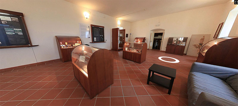
THE MUSEUM IN FOSSATO DI VICO
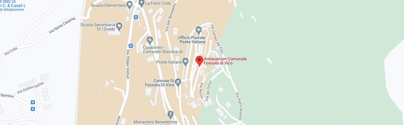
CONTACTS

Antiquarium

Via Mazzini, 16 – Fossato di Vico (PG)

+39 075 919591

GALLERY

  • OPENING HOURS

NOVEMBER-MARCH
Saturday: 10 am – 12 am / 2.30 pm – 5.30 pm
Sunday: 10 am – 12 am / 2.30 pm – 5.30 pm

APRIL-OCTOBER
Saturday: 10 am – 12 am / 3.30 pm – 6.30 pm
Sunday: 10 am – 12 am / 3.30 pm – 6.30 pm

  • TICKETS

Regular price: € 3,00

Reduced price: € 2,00
children 7-14 years old – over 65 years old – students – groups with more than 15 people

Free admission: residents in Fossato di Vico, children 0-6 years old, disabled guest and escort, teachers and professional visiting for research purposes